Regional Biomass Mapping Sweden
General Area Description
Sweden is situated almost completely in the boreal forest region, though the southernmost parts are within the hemi-boreal and nemoral regions. Its total land area is 40.8 Mha, of which 23.3 Mha is productive forest land, 5.2 Mha is mountainous vegetation, 5.1 Mha is wetland and 2.9 Mha is farmland according to the Swedish National Forest Inventory (Fridman et al., 2014; Skogsdata, 2015).
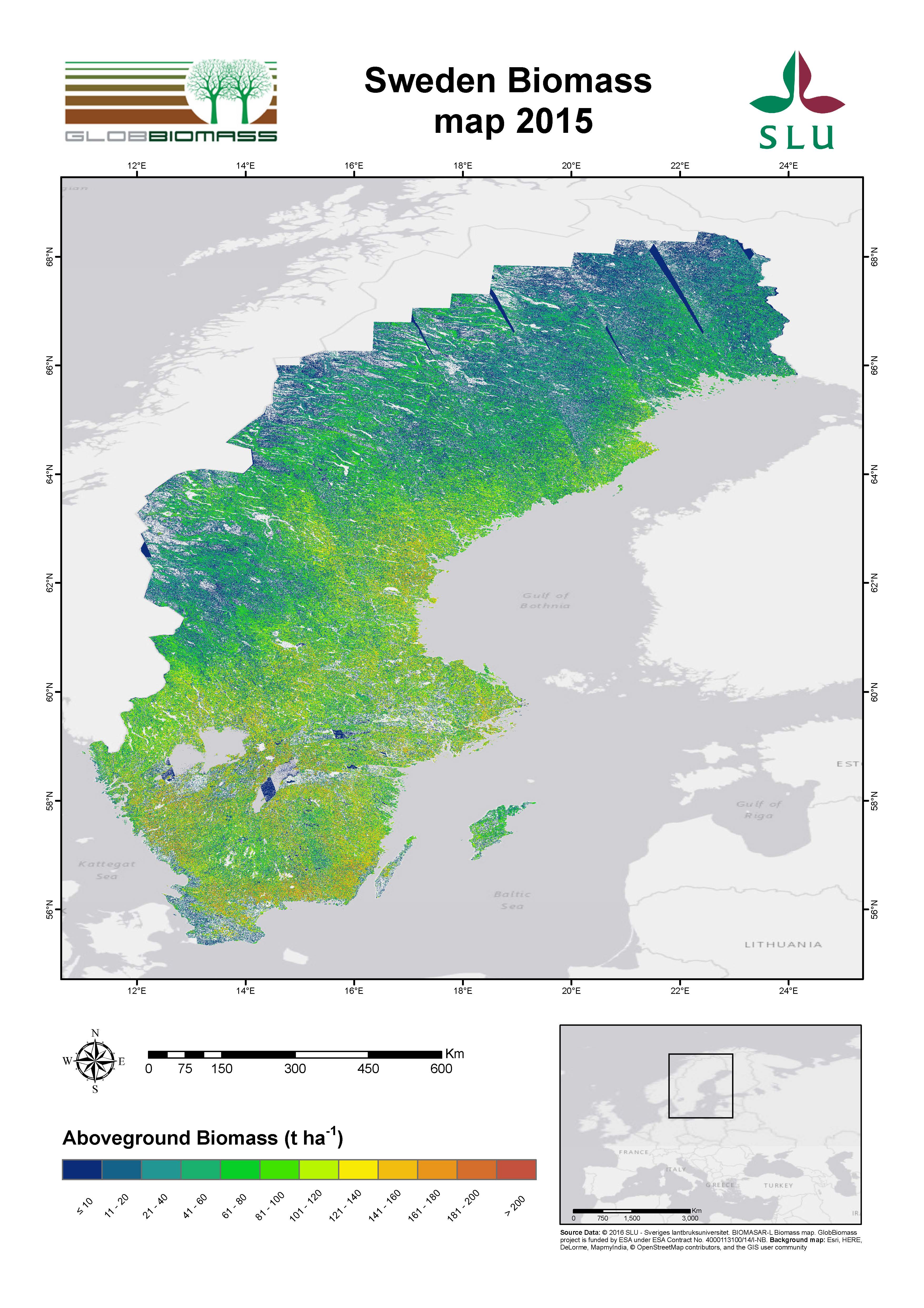
Regional Mapping Product – Reference Year 2015
| Spatial Data |
Product 1: ALOS-2 PALSAR-2 images registered 2015, forest land mask (pixel size: 25 m) derived from a 1:100 000 scale topographic map |
| Additional Data |
Land cover map “Geografiska Sverigedata-Vägkartan”, from the Swedish Land Survey. |
| Training Data |
No training data were used. |
| Algorithm |
BIOMASAR-L |
| Product Preview |
 |
Development
|
Swedish University of Agricultural Sciences |
| Information |
contact@globbiomass.org |
| Download pdf-map |
Sweden Biomass map 2015 |
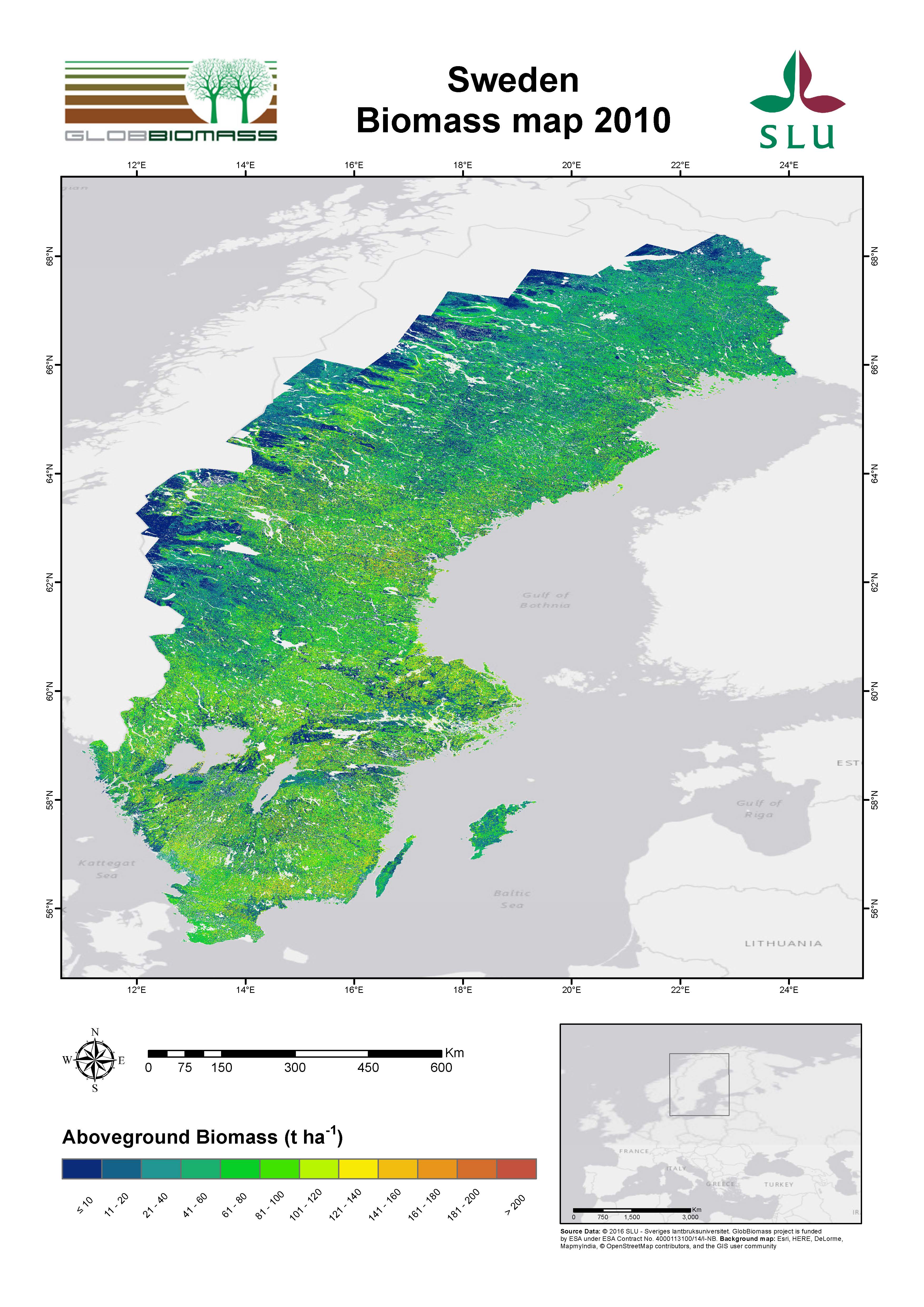
Regional Mapping Product – Reference Year 2010
| Spatial Data |
SPOT 4 and SPOT 5 images registered between 2008 and 2010, forest land mask (pixel size: 25 m) derived from a 1:100 000 scale topographic map |
| Additional Data |
Land cover map “Geografiska Sverigedata-Vägkartan”, from the Swedish Land Survey. Urban and water are set to 0 in the unmasked version |
| Training Data |
Field data collected between 2006 and 2010 by the Swedish National Forest Inventory (http://www.slu.se/riksskogstaxeringen) |
| Algorithm |
k-Nearest Neighbours |
| Product Preview |
 |
Development
|
Swedish University of Agricultural Sciences |
| Information |
contact@globbiomass.org |
| Download pdf-map |
Sweden Biomass map 2010 |
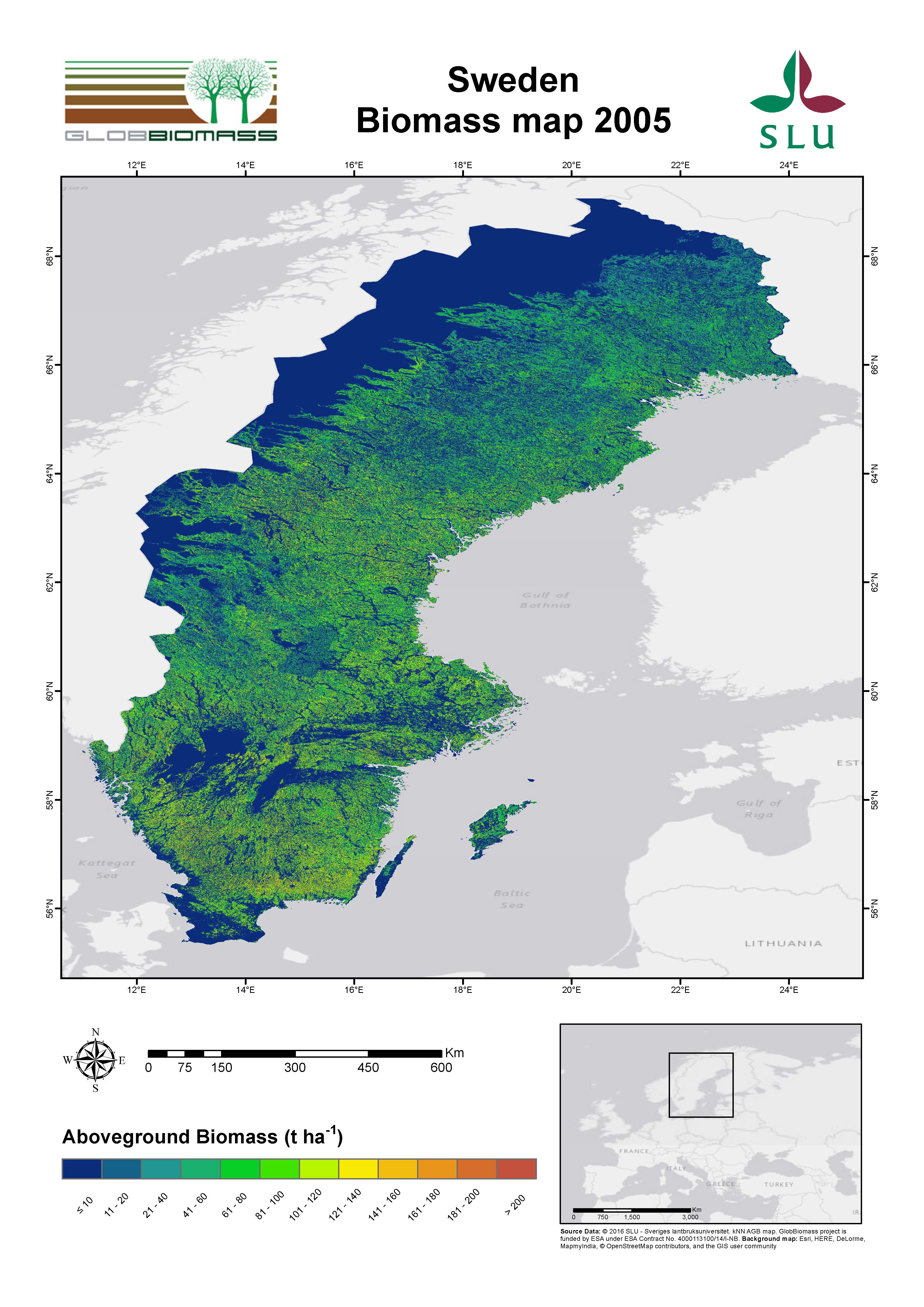
Regional Mapping Product – Reference Year 2005
| Spatial Data |
SPOT 5 images registered between 2005 and 2006, forest land mask (pixel size: 25 m) derived from a 1:100 000 scale topographic map |
| Additional Data |
Land cover map “Geografiska Sverigedata-Vägkartan”, from the Swedish Land Survey. |
| Training Data |
Field data collected between 2001 and 2006 by the Swedish National Forest Inventory (http://www.slu.se/riksskogstaxeringen) |
| Algorithm |
k-Nearest Neighbours |
| Product Preview |
   |
Development
|
Swedish University of Agricultural Sciences |
| Information |
contact@globbiomass.org |
| Download pdf-map |
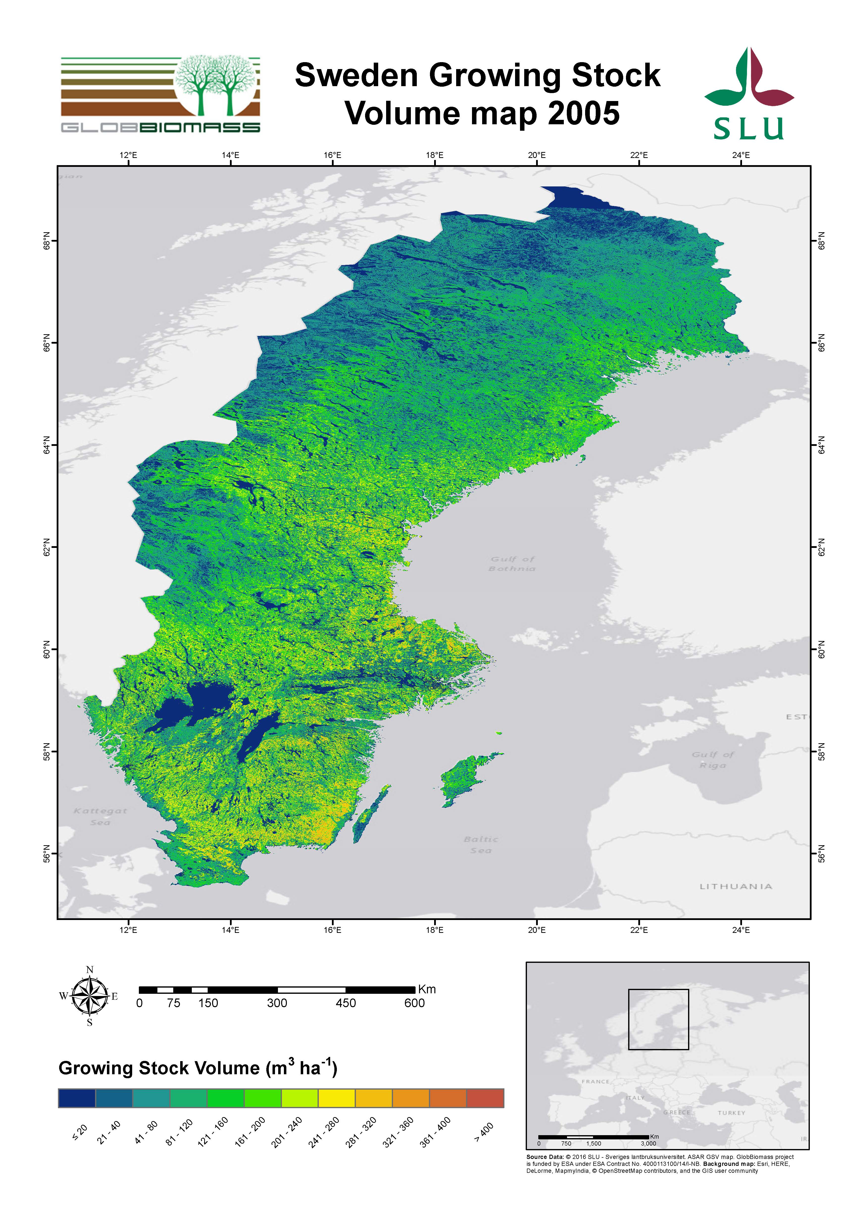
Sweden Biomass map kNN 2005 /Sweden Biomass map kNN ASAR_merged_2005/ Sweden Biomass map ASAR GSV 2005
|
|
|