General Area Description
The South African regional site covers 333 500 km2 and is situated along a 1300 km North-South transect with a large precipitation gradient and various types of soil, such as granites and basalts. It contains various forest types: savannas with an AGB mostly below 100 t ha-1, enormous forest plantations stretching over hundreds of kilometres with various biomass classes of pine and eucalyptus, indigenous dense forests, and coastal forests such as thickets. It also includes the Kruger National Park with natural bush and tree savanna.
Regional Mapping Product – Reference Year 2015
| Spatial Data | ALOS PALSAR mosaic data acquired in 2015, SRTM |
| Additional Data | South Africa LandCover; Landsat tree cover |
| Training Data | 56 1-ha in situ biomass plots from CSIR, measured in 2015 and 2016 in Eastern South Africa |
| Algorithm | Inversion of a HH and HV based water cloud model using the Bayesian method. The parameters of the water cloud model are estimated using the in situ data plots and the Landsat tree cover map. The variabilities of the intensities used as inputs of the Bayes algorithm are derived from the MIPERS model. |
| Product Preview | 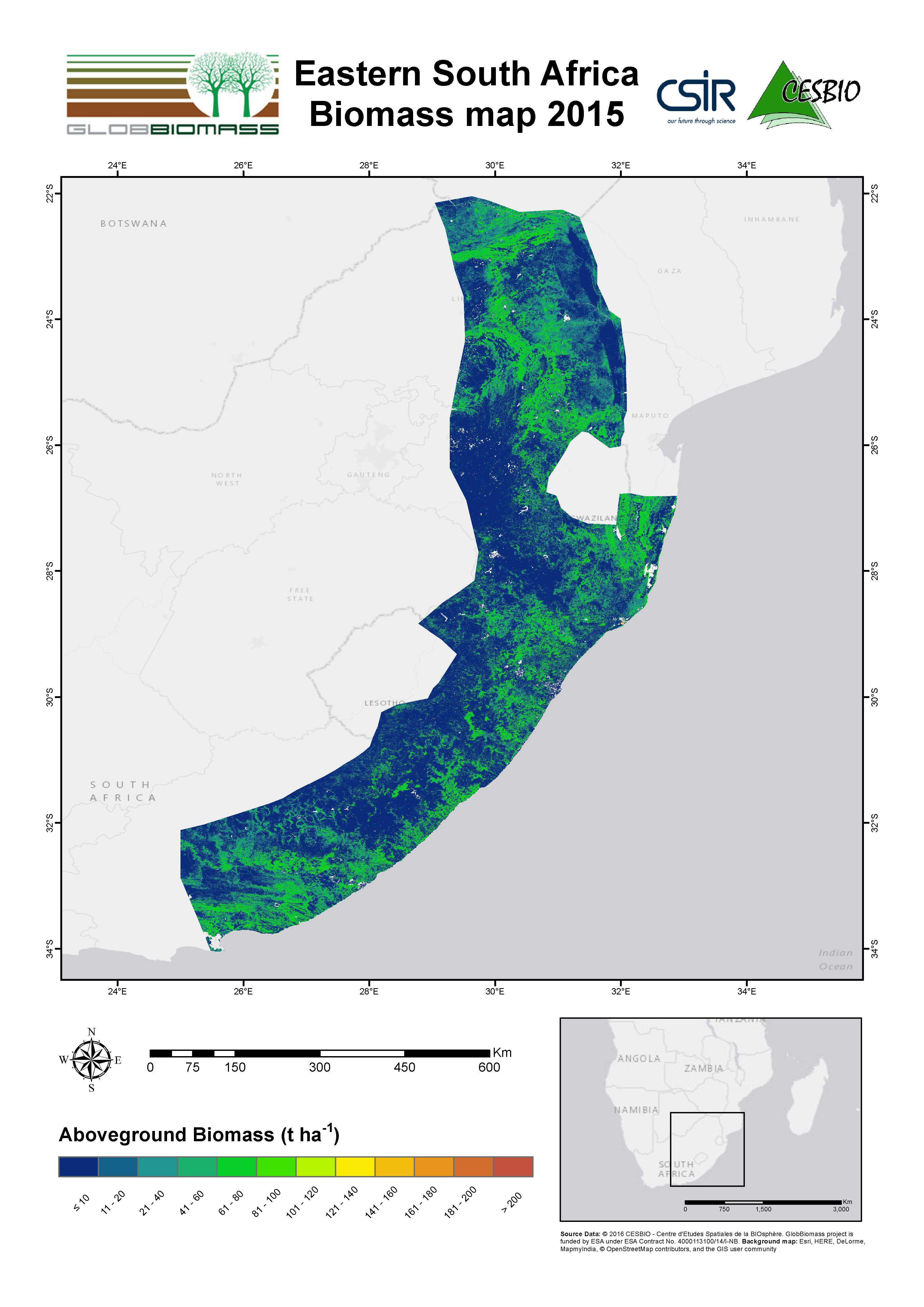 |
| Development |
CESBIO – Centre d`Etudes Spatiales de la Biosphère, France |
| Information | contact@globbiomass.org |
| Download pdf-map | Eastern South Africa Biomass map 2015 |
Regional Mapping Product – Reference Year 2010
| Spatial Data | ALOS PALSAR mosaic data acquired in 2010, SRTM |
| Additional Data | CCI LandCover; Landsat tree cover |
| Training Data |
National Inventory of Forest Condition |
| Algorithm | Inversion of a HH and HV based water cloud model using the Bayesian method. The parameters of the water cloud model are estimated using the in situ data plots and the Landsat tree cover map. The variabilities of the intensities used as inputs of the Bayes algorithm are derived from the MIPERS model. |
| Product Preview | 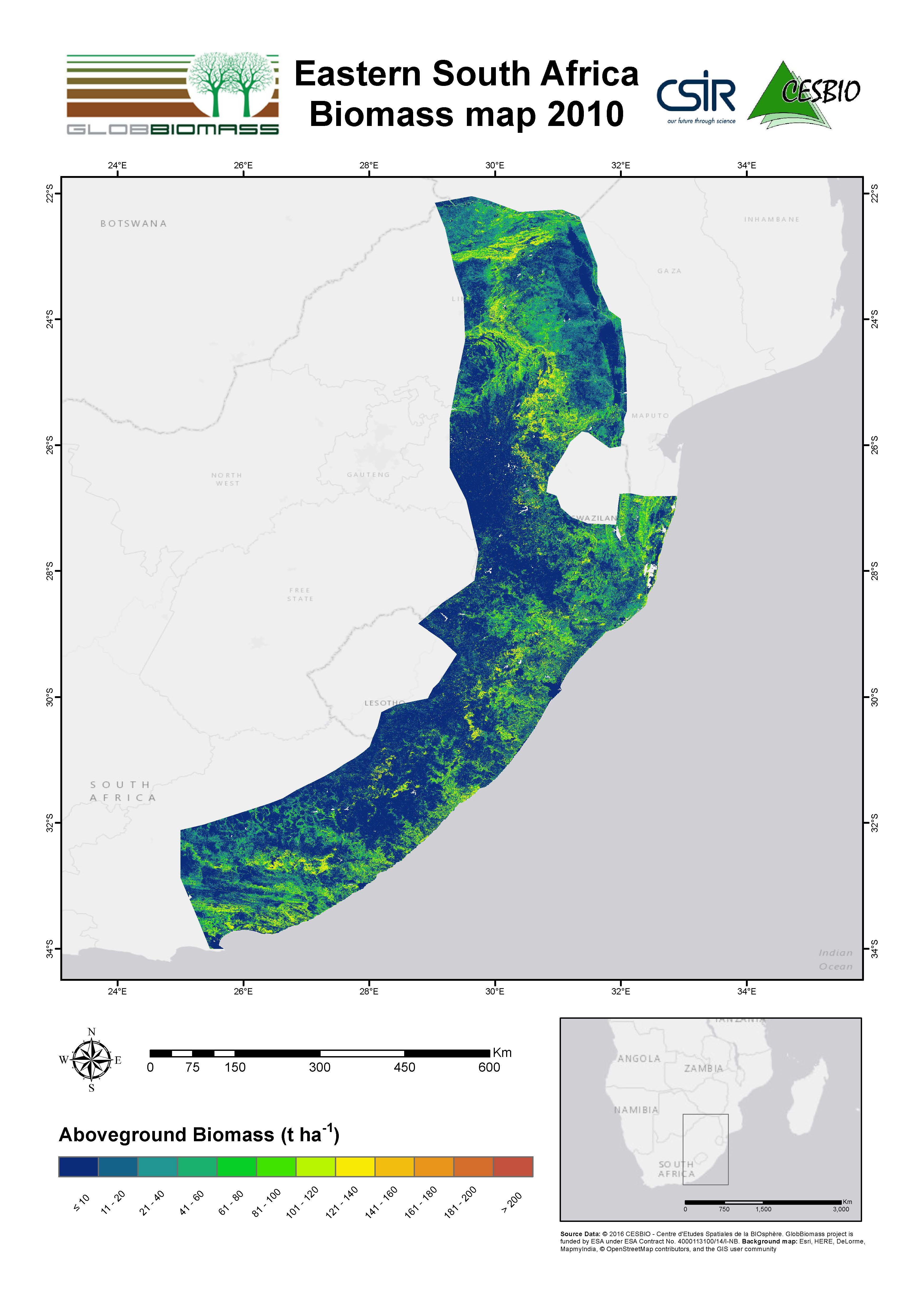 |
| Development |
CESBIO – Centre d`Etudes Spatiales de la Biosphère, France |
| Information | contact@globbiomass.org |
| Download pdf-map | Eastern South Africa Biomass map 2010 |
Regional Mapping Product – Reference Year 2007
| Spatial Data | ALOS PALSAR mosaic data acquired in 2007, SRTM |
| Additional Data | South Africa LandCover; Landsat tree cover |
| Training Data |
Lidar-derived biomass map from CSIR, measured in 2004 in Eastern South Africa |
| Algorithm | Inversion of a HH and HV based water cloud model using the Bayesian method. The parameters of the water cloud model are estimated using the in situ data plots and the Landsat tree cover map. The variabilities of the intensities used as inputs of the Bayes algorithm are derived from the MIPERS model. |
| Product Preview | 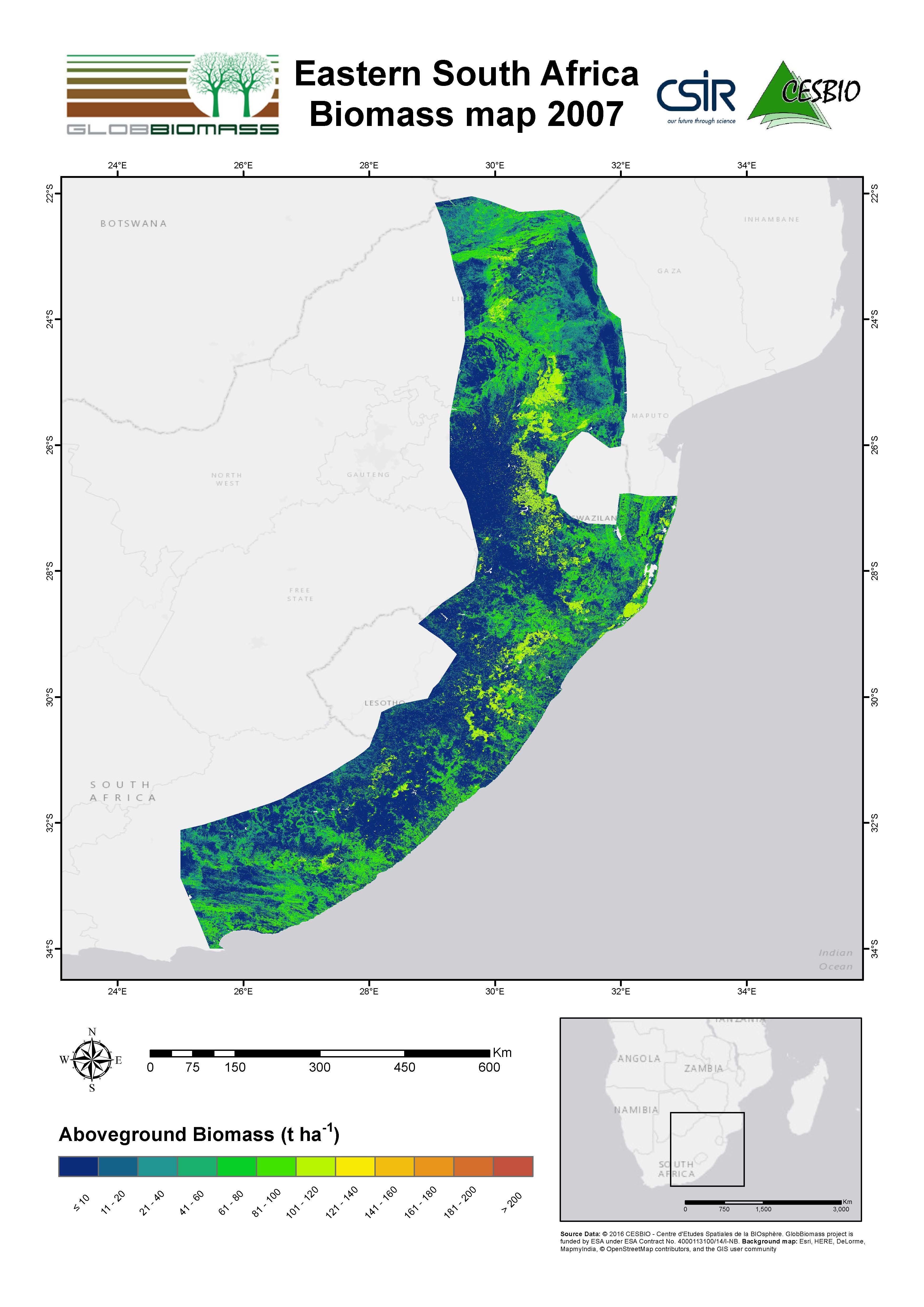 |
| Development |
CESBIO – Centre d`Etudes Spatiales de la Biosphère, France |
| Information | contact@globbiomass.org |
| Download pdf-map | Eastern South Africa Biomass map 2007 |