General Area Description
Poland belongs to the temperate climate zone with maritime and continental influences. The forested area amounts to about 91,630 km², which is 29.3% of the area of Poland. More than 77% of the total forest area is managed by the State Forests National Forest Holding, whereas the rest belongs to the national parks, private owners and cooperative owners. Coniferous (pine) forest habitats predominate, accounting for 51% of the total forest area, while broadleaved (beech) forest habitats account for 49%.
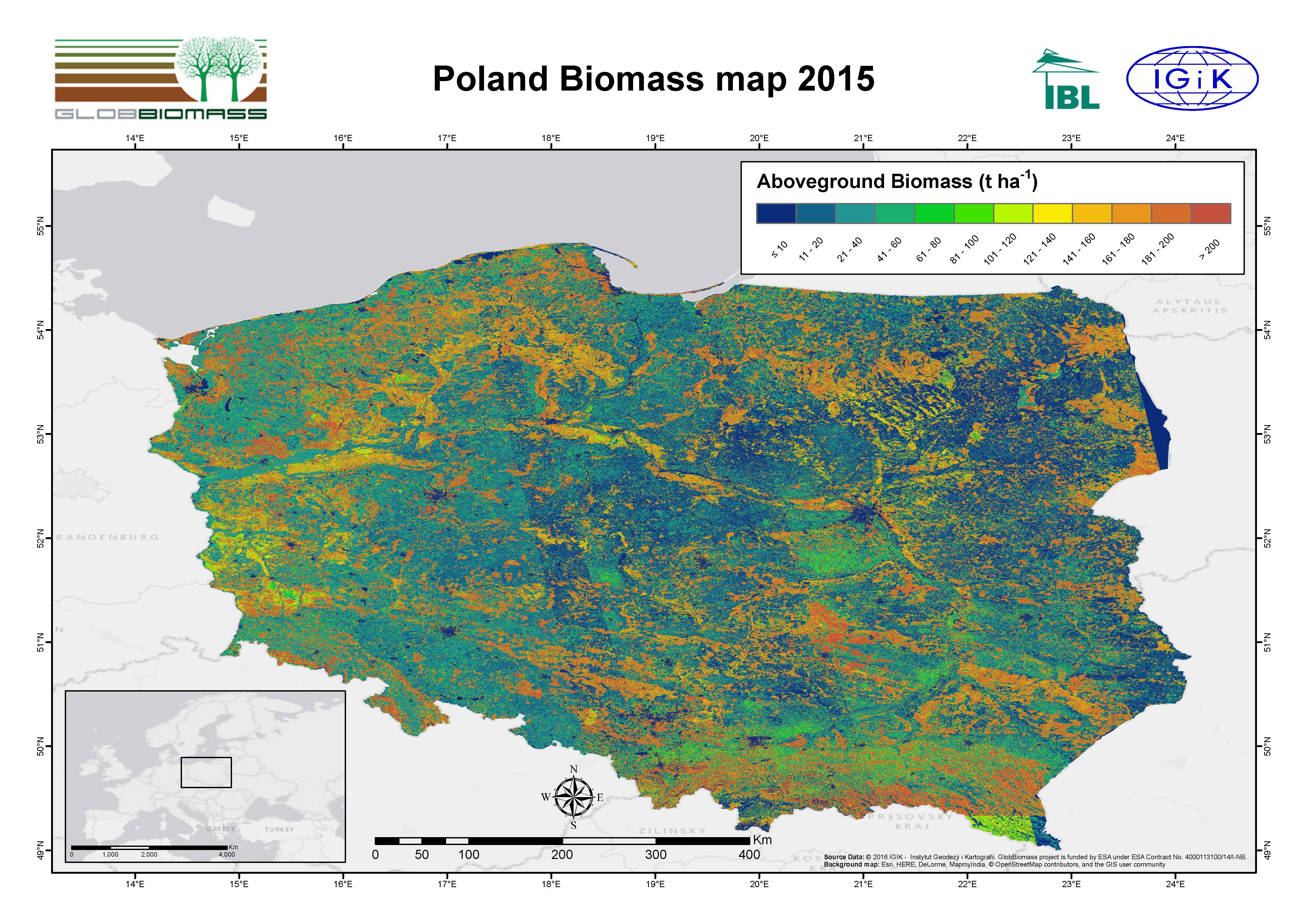
Regional Mapping Product – Reference Year 2015
| Spatial Data | Time series of Sentinel-1 data (2015/2016), mosaic of Sentinel-2 (4 bands) (2015-2016) |
| Training Data | National Inventory of Forest Condition |
| Algorithm | Random Forest Regression |
| Product Preview
|
 |
| Delevopment |
Remote Sensing Center, Institute of Geodesy and Cartographya, Poland |
| Information | contact@globbiomass.org |
| Download pdf-map | Poland Biomass map 2015 |
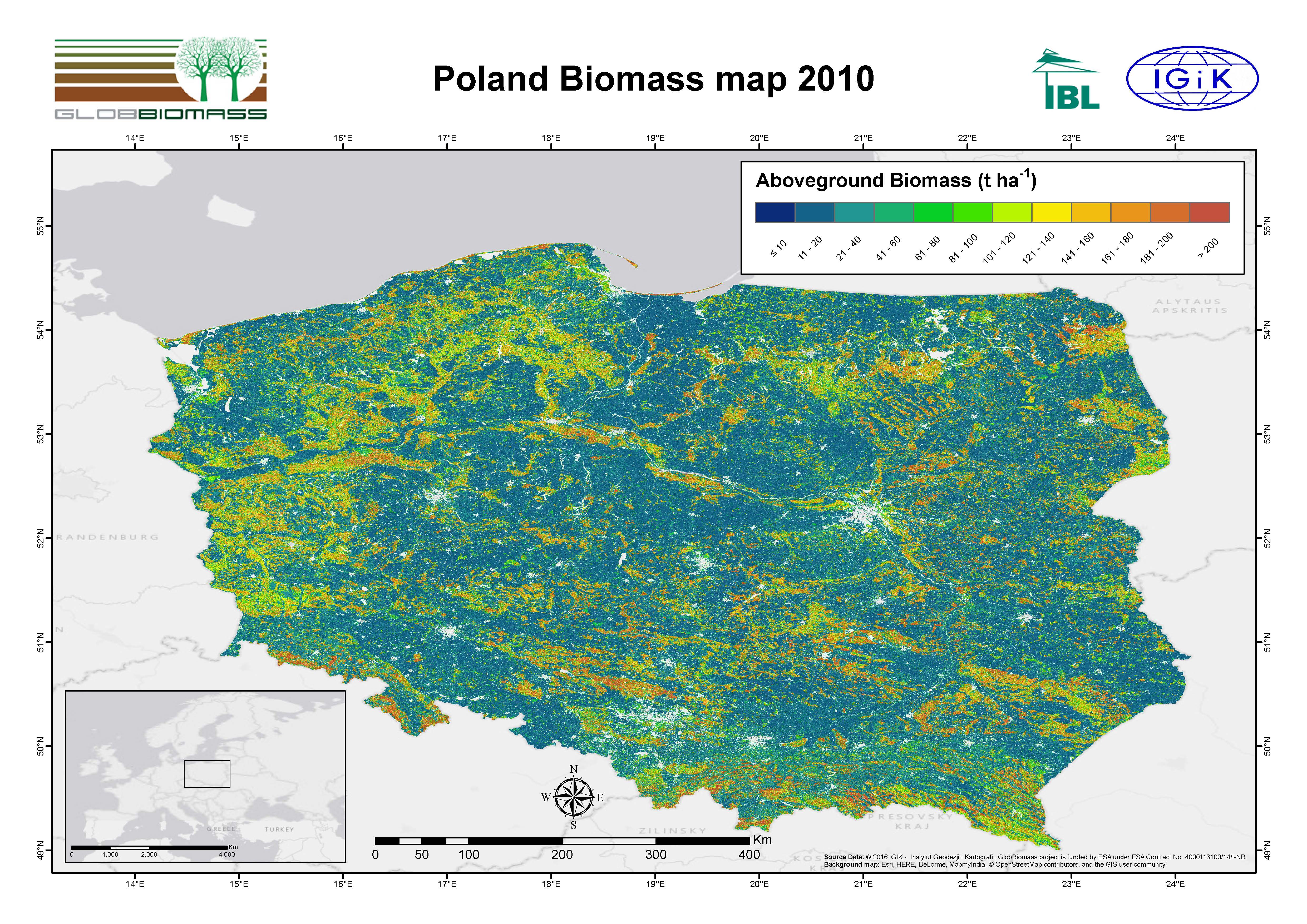
Regional Mapping Product – Reference Year 2010
| Spatial Data | ALOS PALSAR dual polarization (2009/10), Landsat 8 Surface Reflectance (4 bands) (2013-2012-2011) |
| Training Data | National Inventory of Forest Condition |
| Algorithm | Random Forest Regression |
| Product Preview
|
 |
| Delevopment |
Remote Sensing Center, Institute of Geodesy and Cartographya, Poland |
| Information | contact@globbiomass.org |
| Download pdf-map | Poland Biomass map 2010 |
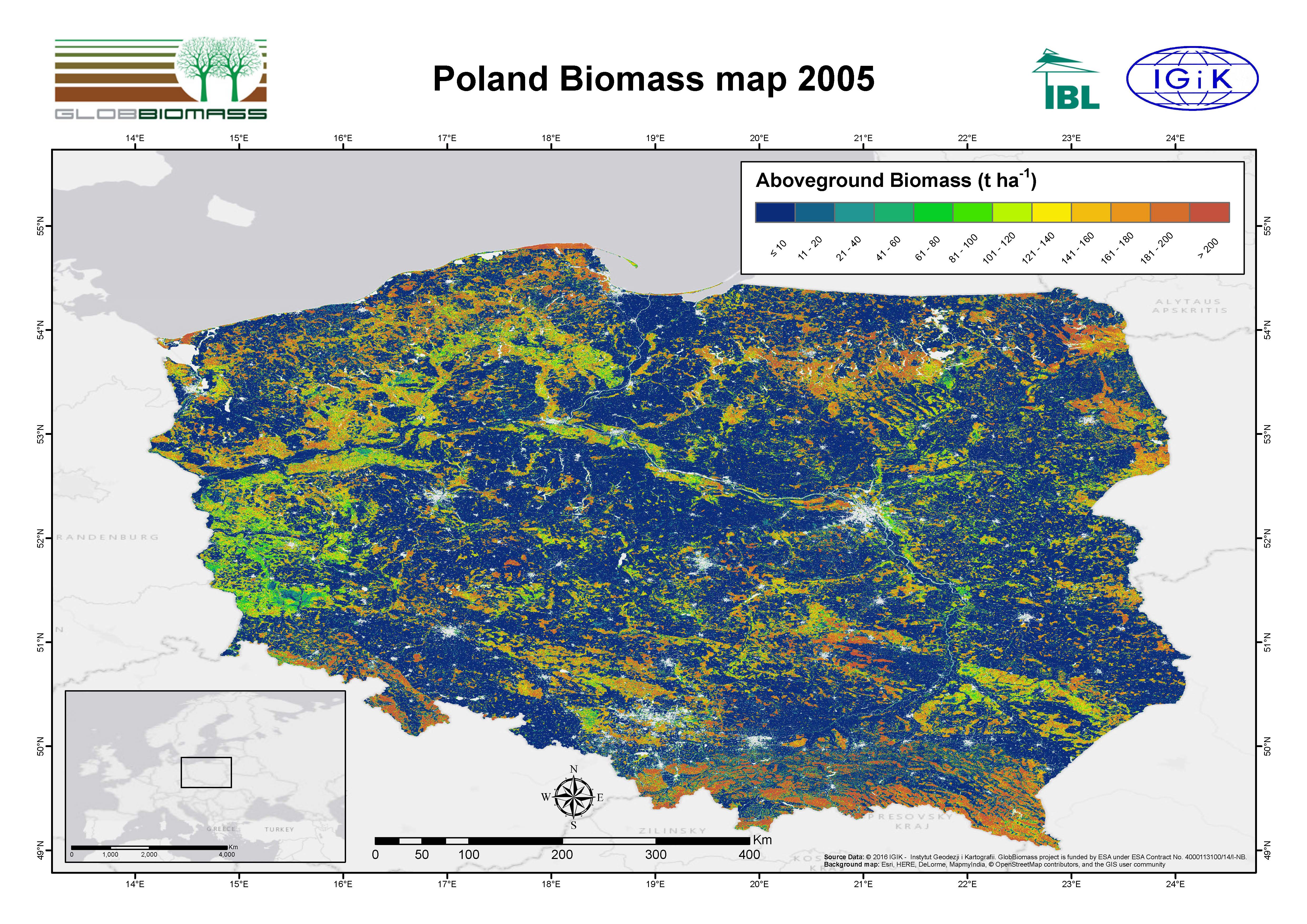
Regional Mapping Product – Reference Year 2005
| Spatial Data | ALOS PALSAR dual polarization (2007), Landsat 5 Surface Reflectance (6 bands) (2005-2006) |
| Training Data | National Inventory of Forest Condition |
| Algorithm | Random Forest Regression |
| Product Preview
|
 |
| Delevopment |
Remote Sensing Center, Institute of Geodesy and Cartographya, Poland |
| Information | contact@globbiomass.org |
| Download pdf-map | Poland Biomass map 2005 |